MONDAY, 04 July
The main part of today was devoted to exploring the Parc national de la Gaspésie. Indeed, this park is the one of the reasons we looked for an RV park in Saint-Anne-des-Monts. The park was created in 1937 to protect the flora and fauna of a unique ecosystem that included alpine, tundra, caribou and moose. It is the last place that Caribou are found south of the St. Lawrence River. Since that time, it has also become a mecca for hikers, bikers, campers, canoeists and kayakers, perhaps the preeminent spot in Quebec. This was another of the Quebec provincial parks that they call a “national” park, but are not under the management of Parks Canada and do not recognize the Parks Canada pass.
The park was about 40 Km from our RV park. QC-299 starts at QC-132 in Saint-Anne-des-Monts and heads south towards the park. The road was good and marked 90 KPH most of the way, so it took less than 30 minutes to reach the park boundary. We expected to find an entrance station there, but there was just a sign. Our map had indicated that QC-299 runs all the way through the park, out the south side, and r on going, so it’s a public throughway.
We knew there was a visitor (discovery) center about mid-way through the park and that was our initial destination. At the discovery center, we learned that we did, indeed, need our paid reservations (which Linda had made the night before) and that there were staff throughout the Parc who might ask to see our confirmation if we came across them. We also got a map that showed the trails and camping areas. A staff member highlighted the three “easy” hikes in the surrounding area.
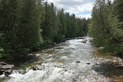
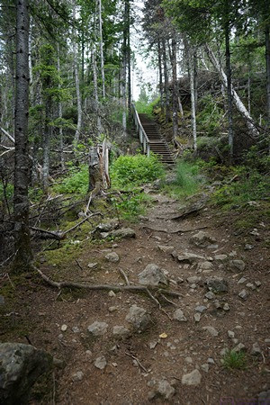
We decided to hike the La Chute Sainte-Anne trail which started just across QC-299 from the discovery center and ran south between the road and the Saint Anne River (Riviere Sainte-Anne) with access to a viewing platform for the Saint Anne waterfall (Chute Sainte-Anne). Further along it crossed over QC-299 and became the La Lucarne trail back to the discovery center with the La Lucarne viewing platform at the highest point.
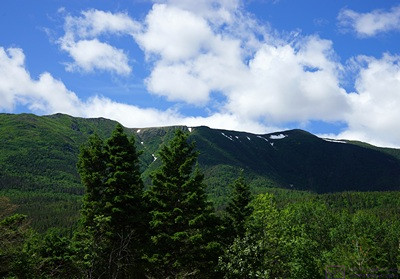
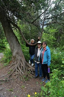
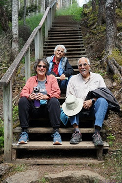
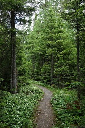
The park encompasses a dramatic terrain of modest (3,000 – 4,000 foot) but steep mountains with river valleys and lakes. It was a dense woodland, and everything that wasn’t road or water seemed to have a thick covering of green trees and plants. The Sainte Anne trail had its ups and downs, but the La Lucarne trail seemed vertical at times. It might have been a language issue at the discovery center, or perhaps a different cultural calibration of the meaning of “easy,” “intermediate,” “difficult,” and “expert” as applied to a hiking trail. In spite of being labeled as “family friendly” in the map guide, there was no way this was an “easy” hike. The two trails combined were 4.2 Km (~2.6 mi) with a time of ~90 minutes. It was not easy and it took us longer, but we made it.
Back at the discovery center we rested on the deck and had a vegetable juice blend for calories and hydration. Everyone was tired, but we looked at what other “easy” hiking options might exist. The best options were down Rte 11, but Routes 14 and 16 formed a loop around the eastern portion of the park. We decided to drive the loop counter-clockwise, starting with Rte 16 and ending up on Rte. 14. The roads were gravel and often very rough. Not “off road” but a good test of the F-150. We had hoped to see Mont Jacques-Cartier, the highest point in the Gaspe peninsula at 1270 m (~4,128 feet), but most of the time the trees were close to the edges of the road and tall, so our views were out the front and rear windows of the truck, and some of them were very good.
By the time we got back to QC-299, everyone was tired and waved off looking for another hiking trail so we headed back to Sainte-Anne-des-Monts. It was a worthwhile visit to a special and spectacular place and we were all glad we went.
When we got back to Saint-Anne-des-Mont, we crossed QC-132 and pulled into the Metro grocery store parking lot. Nancy needed a couple of baguettes for dinner tonight and breakfast tomorrow and we went in to check it out for a possible reprovisioning trip tomorrow. It was a very nice store. Dinner was vegan cream of mushroom soup, made from scratch, with sherry and freshly baked croutons. The remainder of the baguettes will be used for a special breakfast dish, to be revealed in a later post.
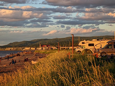
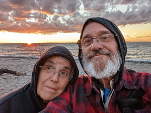
When I got our folding chairs out of the back of the truck, I discovered that the bed cover is not dust proof; everything was coated with a fine grey powder, acquired on the Rte 16 -14 loop around the Parc. Cleaning the back of truck would have to wait until tomorrow. For now, we relaxed for a bit after dinner and then went to the beach to watch the sun set, something for which this area is noted.
There were quite a few people there already, some with lawn chairs, some sitting on large pieces of driftwood, and others sitting or lying on the sand. The campground only allows fires on the beach and there were several already going, even beyond the borders of the campground, which is private housing in both directions. We stood and waited, and finally started taking pictures as the color developed. When the sun drops low in the sky the temperatures follow so once the color faded, we returned to our rigs for the night.
All good blogs end with a sunset, right? So here it is.
…
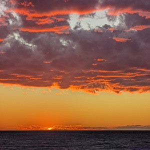
Amazing sunset!
I do love me a good sunset.