TUESDAY 06 September
(There are 12 photos in this post, spread throughout the text.)
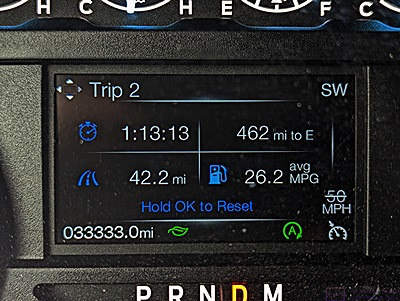
This is the information display in the center of the F-150 dashboard (just above the steering column). The number in the lower left corner of the display, 033333.0 is the total mileage on the vehicle. It’s a palindrome (I ignore the decimal point). Such numbers only occur every 11,111 miles, up to 099999.0, and then every 111,111.1 miles up to the limit of the odometer at 999999.9 miles. Also of note is the number, mid-right, of 26.2 ave mpg. I can get these numbers under the right conditions of speed and terrain, and I actually had this number up past 27 and almost to 28, but the slightest hill reduces it right away. It was somewhere between 23 and 24 by the time we got back to camp.
Our day was a bit unusual in that it consisted of several distinct segments. Our normal morning routine was shortened to one cup of coffee and no breakfast as we had to drive into Moncton early to do the grocery shopping that we were unable to do yesterday due to the Labor Day holiday. I was cleaning out e-mails on my iPad while having that cup of coffee, and noticed one from last Monday (August 29) indicating that our Kohler whole house generator had shut down due to a fault, was “Not in Auto,” and would not restart automatically. The fault was identified as “Low Generator Voltage AB.” Not being in auto-start was bad, and that was a fault message I had never seen before. Yikes. We rely on the genset to make sure our sump-pump and well-pump have power year-round, and that the furnace has power in the winter.
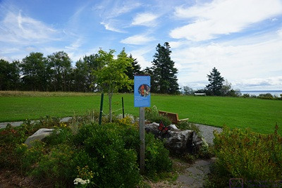
Our first stop in Fundy National Park, after the Visitor Center, was the Butterfly Garden. It contained an extensive assortment of plants designed to attract and sustain butterflies, including the Monarch Butterfly
While that was not a good situation, we were fairly sure we had not lost power as: 1) the Kohler OnCue Plus system would have notified us of the loss of utility power (or loss of connectivity), 2) our DTE (electric utility) app would have alerted us to the loss of power (I think), and; 3) We might have heard from our neighbor that the power was out. Still, it was bad on several levels: 1) That it happened over a week ago, and the genset had been unavailable since that time; 2) that neither of us paid careful enough attention to the notification when it arrived at the time of the fault; 3) We knew there were bad storms last week in our home county, and; 4) our battery-powered backup sump pump was not yet installed, so if the power did go out we would not have a functional sump pump. Not good.
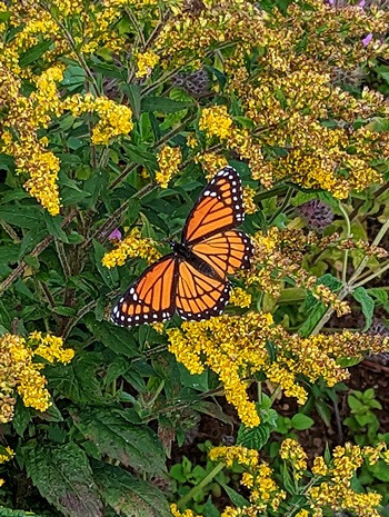
Linda managed to capture this photo of an actual Monarch butterfly in the Butterfly Garden at Fundy National Park.
I texted our neighbor, Mike, who has been checking on the house for us occasionally, and asked him to stop by the house to check the sump-pump closet and put the genset back in auto. I then texted Shawn, at GenPro LLC (our local servicing Kohler dealer), and asked if he would stop by the house and check that the unit was actually functioning properly.
I heard back from both of them within an hour in the affirmative. Mike indicated that he had reset the fault, run the genset, shut if off, and put in back in Auto. The display said the next exercise cycle was set for next Monday (September 5). (We could also check the status using the Kohler OnCue+ app on our phones, iPads, or laptop computers.) Shawn indicated that he would be there sometime today.
Another series of notifications appeared around 13:20 (our local time). I presumed they were the result of Shawn working with the genset, but I did not get a text or phone message confirmation to that effect. We did, however, get his electronic invoice that evening with a short explanation of what he found and what he did. All of the wiring connections were tight but he found the gas line shutoff valve partially closed. He opened it fully and ran the genset,. He said it ran perfectly. I trust his diagnostic and repair skills, but we probably won’t for sure that this was the problem until next Monday (September 12) when the next scheduled exercise occurs.
But I’ve jumped ahead in terms of the order of events today. Some of that communication took place before we left to drive to the Vaughn-Hadley Sobeys in Moncton for groceries, some of it took place after we got there, and some of it took place later in the evening.
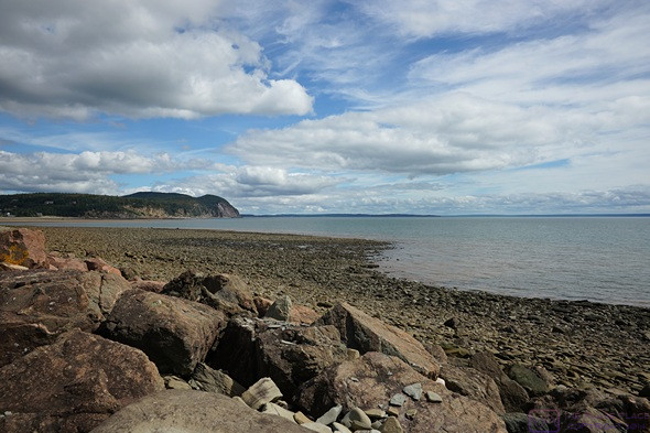
The view of Alma Beach looking north from Cannontown Beach in Fundy National Park. The amount of exposed ocean floor at low tide is extensive. There were people at the water’s edge, but probably to small to see in this photo.
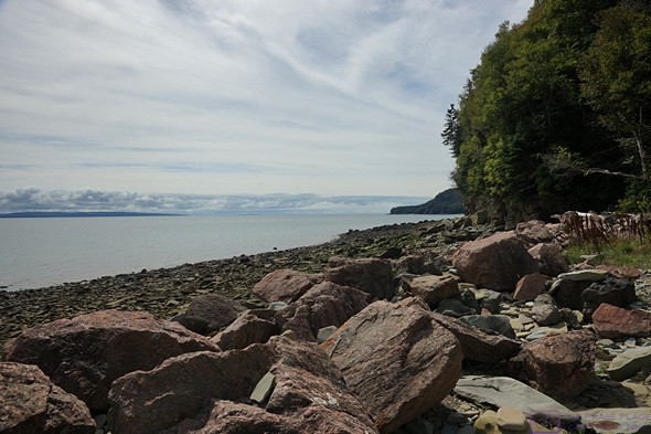
This is the view looking south from Cannontown Beach in Fundy National Park. The North Atlantic Ocean is off to the right, but still a long way away. The Bay of Fundy is over 400 km (~250 mi) long, and 100 km (~61 mi) wide at its mouth on the Gulf of Maine
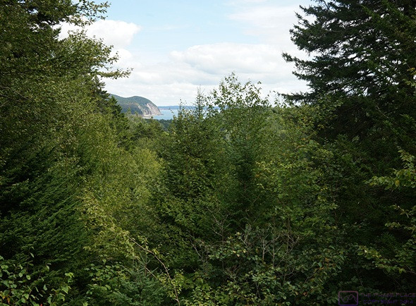
A view looking north from the Dickson Falls Trail of the headland and cliffs by the village of Alma.
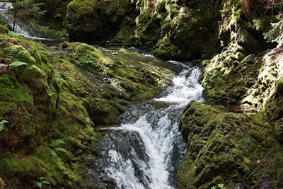
The Dickson Falls Trail had two routes. The upper route was partially closed for construction, but we wanted the lower route anyway as it descended 65 feet into the gorge downstream of the actual waterfall. Before getting to the actual waterfall, the trail crossed and then worked its way up alongside a long cascade.
We encountered several construction zones on the drive into Moncton, but collectively they only cost us about 20 minutes driving time. Each way. We bought just enough fresh food to get us through the next three days and stocked up on a variety of non-perishable items.
On the way back to our campground we stopped at the Petro Canada on Hwy-114 and topped up the fuel tank. We encountered the same construction zones on the way back to camp, of course. We also saw a school bus (on the road, not parked), and noticed a lot of RVs headed towards Moncton. School is back in session, and the Labor Day weekend probably marked the end of summer vacations, just as it does in the States. We recognized several of the RVs as having been in our section of the campground when we left this morning. When we got back to our site, there were only three other RVs left in our section.
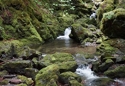
Mid-way up the Dickson Falls cascade. The eco-system of this gorge is different than the rest of the parkland that surrounds it, and there was a protected lichen here that is able to survive underwater.
Back in camp, Linda rearranged the refrigerator to make everything fit, and put the non-perishable items in their usual cabinets. We loaded what we needed for the next part of our day, which was hats, jackets, the SONY SLT a99v camera bag, and the carrier harness.
It was ~42 km (~26 mi) south on NB Hwy-114 to the S/E entrance to Fundy National Park (Parks Canada). It took us an hour to drive there, as the maximum posted speed limit was 80 km/hr, slower through small villages, and much slower through several construction zones. Two of them had flaggers controlling traffic and the longest one, where asphalt pavement was being placed, had an escort vehicle as well. We also encountered a couple of places with automated temporary traffic signals, but it was still a good drive through rolling wooded countryside and small villages with views of the Bay of Fundy, salt marshes, and some agricultural fields. It was also a good preview, as NB Hwy-114 South through the park will be our route to get to the St. John, New Brunswick area on Thursday.
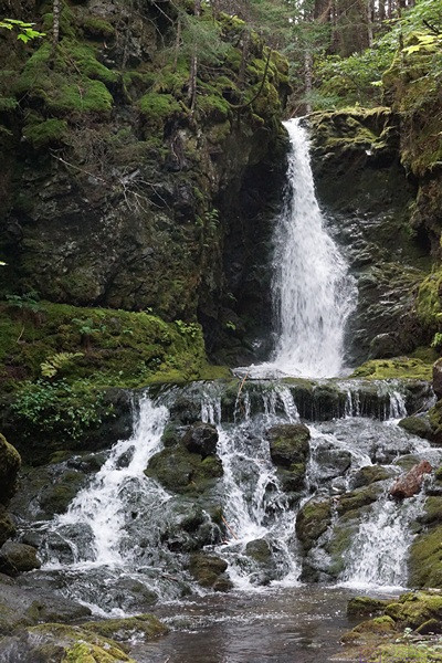
Dickson Falls. The source of the water is a pond some distance into the park. The pond, and the stream that flows out of it all the way to Chignecto Bay, are completely contained within Fundy National Park, and are very pristine.
Not long before reaching the park, I noticed that the odometer on the truck (total mileage) was about to create a palindrome (symmetrical number or word ). I have always enjoyed the patterns formed by the odometer readings in our vehicles, such as 012345.6, but I especially like palindromes. I had a car behind me, but managed to pull off the road just in time to capture the first image in this post.
We passed through the quaint little town of Alma just before entering the Park. Fundy National Park encompasses 206 square kilometers, including a section of coastline on the Chignecto Bay portion of the Bay of Fundy. It is also a UNESCO Biosphere Reserve, which protects and preserves an Acadian Coastal Forest comprised of 32 different species of trees, and other flora and fauna that depend on that forest for survival. It is, however, a small portion of the much larger Bay of Fundy Biosphere Reserve.
From the Parks Canada website:
There are 37 national parks and 10 national park reserves in Canada that represent 31 of Canada’s 39 terrestrial natural regions and protect approximately 336,343 square kilometers of Canada’s lands. … A national park reserve is an area that is managed like a national park but is subject to one or more Indigenous land claims. These land claims are being negotiated between the federal and Indigenous governments. Indigenous peoples continue to use the land for traditional hunting, fishing, and trapping. The Canada National Park Act applies to the national park reserve and provides the same protections to those of national parks. The resolution of the land claims finalizes the boundaries and establishment conditions, and the national park reserve can be brought under the Canada National Parks Act as a national park.
The largest park, Wood Buffalo NP, is ~45,000 square kilometers (~17,360 square miles) and is both a UNESCO WHS and Biosphere Reserve. The smallest park, Georgian Bay Islands, is just 14 square kilometers (~5 square miles) and is a UNESCO Biosphere Reserve. Parks Canada also manages National Historic Sites, which are places of great historic and/or cultural importance.
We started our visit to Fundy National Park at the Visitor Center and Gift Shop, where we got a couple of maps and some advice about trails, and learned that the Park offered an interesting assortment of activities. The Bay of Fundy (of course), with access to the ocean floor at several “beaches” including Alma Beach. Hiking (of course, and lots of it), along with canoeing, kayaking, and bicycling. A swimming pool at Cannontown Beach (closed for the season); Accommodations (motel & cottages). Four campgrounds (at least one closed for the season as of yesterday) as well as lots of backcountry camping. And a golf course (that looked to be 9 holes).
Most of the hiking is long and difficult, so we confined our visit to the area along the shore from the Visitor Center to Point Wolfe Campground at the end of Point Wolfe Road and the in/out Herring Cove Road.
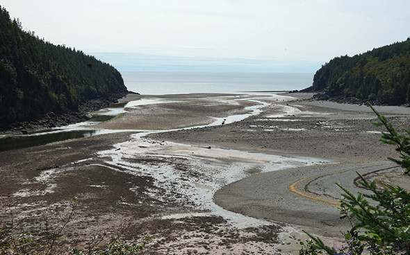
From the Pointe Wolfe Campground area at the end of Point Wolfe Road, we hiked out on the Shiphaven Trail towards the covered bridge. The Point Wolfe River flows down to this inlet from deep in the park, seen here near low tide. This bay was once bustling with commerce, specifically logging and lumber milling, and eventually shipbuilding. All of that is gone now, and the forest is recovering from the effects of that activity.
Our big hike was to Dickson Falls. It was mix of dirt (with tree roots), gravel sections, and wooden stairs, bridges, and boardwalks. It was considered moderate with a 65 ft elevation change. I did not count all of the stairs, but I was quite certain it was more than we had to deal with at Hopewell Rocks Park this past Sunday. But we handled it OK, and it was a cool hike, figuratively and literally; it was noticeably cooler down in the gorge below the waterfall than in the surrounding forest. The water for the falls originates in the park, finally flowing to the Bay of Fundy. It was incredibly clean, as it is entirely within the management jurisdiction of the park.
We did a smaller return hike on the Shiphaven Trail from the Point Wolfe Beach area to the covered bridge and back. Still a lot of stairs, but usually only a few at a time.
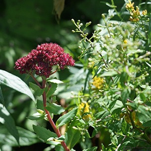
After driving Herring Cove Road to its endpoint, we started down the trail to Herring Cove Beach. We could see that the water was still a long way below us, and the first set of stairs looked to be 100 steps in a straight line with no landing. We decided that was not for us today, and turned back. On the way back up I saw this flower and, not wanting to come away empty-handed, took its picture.
On the way pack up Pointe Wolfe Road we turned off onto Herring Cove Road. It was a long way down from the trailhead at the parking lot to the ocean. We might have done this as our first trail, but had already done the Dickson Falls Trail and the Shiphaven Trail. With the afternoon wearing on, and our bodies telling us we had done enough hiking for the day, we took a pass on this one. Again, we came away with the new understanding that staying in one of the campgrounds here for a week would allow us to do more trails like this, at the rate of one a day, or perhaps one harder one in the morning and an easier one after lunch.
Our second-to-last stop was the Butland Lookout scenic pullout part way up Hwy-114 into the park. We had a commanding view of part of the east side of the park and the Bay, and I was able to create this composite image:
This is a composite of 10 photos created with MS Image Composite Editor. The photos were taken at the Butland Lookout with the camera set to Manual mode so that all of the photos had the same exposure. The photos were taken from left to right with the left 1/3rd of each photo overlapping the right 1/3rd of the previous one. The zoom lens was set at 50 mm, to minimize distortion across the photos and provide a “natural” perspective that composites well.Our final stop was back at the Gift Shop where we picked up a T-shirt (for Linda) and two FNP logoed “moose mugs”.
The drive back to camp was pleasant, even with the road construction delays. We got back to camp in the late afternoon, and Linda set about making dinner right away. She wanted to grill a couple of our smoked vegan sausages, but the mosquitoes were just too thick and persistent. She made a bowl of cole slaw, heated up a can of Bush’s Maple & Brown Sugar beans, sauteed some onions, and pan-grilled the sausages inside the trailer. We had some of the AHA Pineapple & Passion Fruit sparkling water with our meal.
We went for a walk after dinner, which is really something we should do at home, weather permitting. We kept moving in order to keep the mosquitoes at bay. The Ponderosa Pines Campground is a nicely laid out and maintained place, in a beautiful location with convenient access to things we wanted to see. The mosquitoes were just part of the nature where we were.
Back at our trailer, we had small glasses of the Black Tower Rivaner wine. I think Golden Oreos made an appearance for dessert. The rest of the evening Linda read and I tried to work on the photos from the park and start writing the blog post. I was a bit tired, and had trouble making photo selections and then adjusting them to my satisfaction. We planned to stay in camp tomorrow, so I put those tasks aside.
…
